Handling layers and excess of information.
Page 1 of 1 (3 posts)
Tags:
None

Registered Member 
|
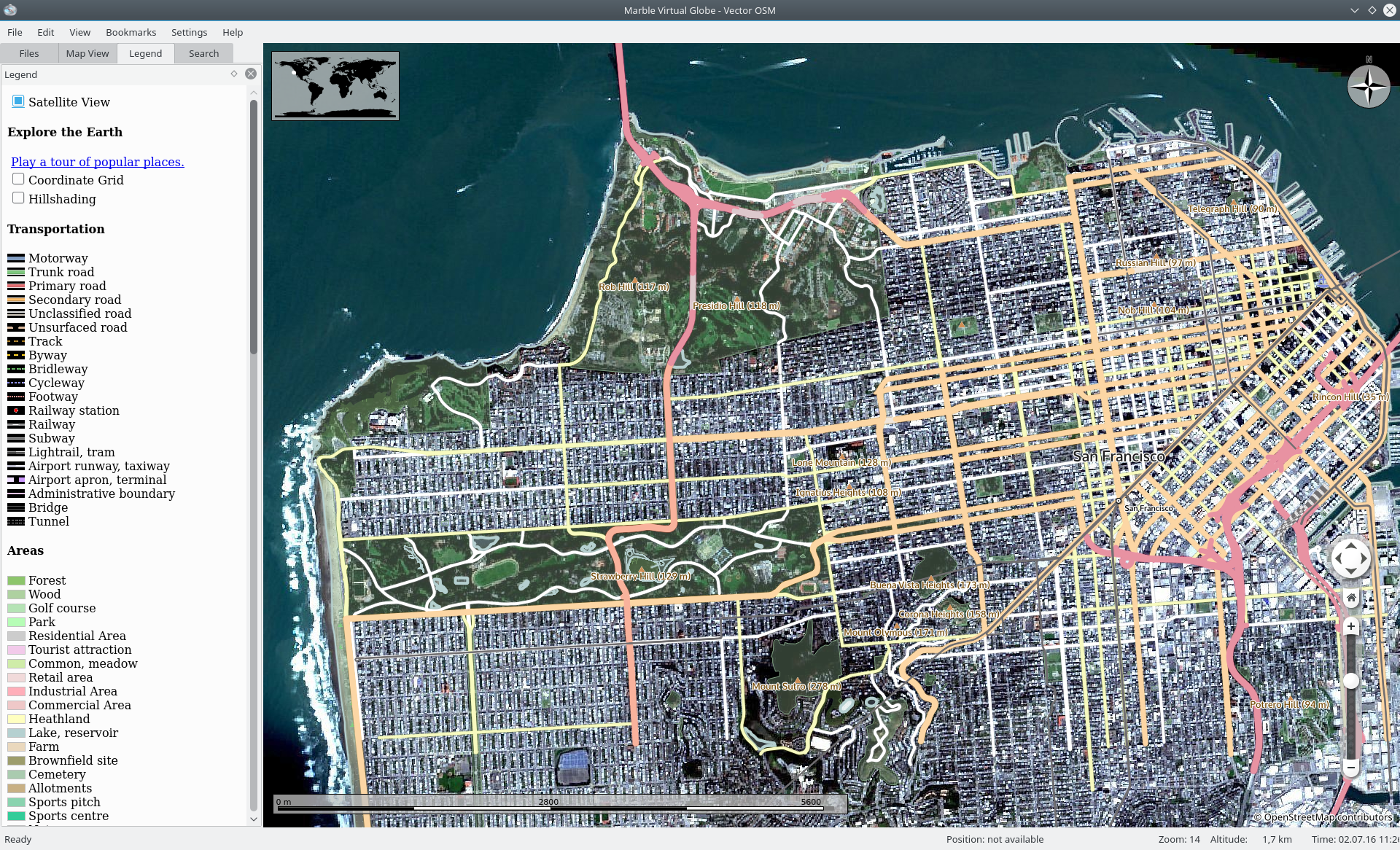
Can layers be superposed, like in mobile apps like Osmand, so you can have a map, and then superpose a public transport and a satellite view, for instance?
Another one: The OSM map has a lot of distracting elements: cafeterías, restaurants, banks, supermarkets, churches, boutiques, etc, etc. It's rather messy. Could it be possible to hide all them and show only what we are interested in? |

KDE Developer
|
About "handling layers": Out of the box this only works to some degree for some map themes: E.g. in the Satellite Map Theme we are blending the cloud layer on top of the satellite layer - and in the legend of the OpenStreetMap theme you will find a checkbox that will let you blend over Hill Shading.
So technically this is possible - however we limit it to those cases where it makes sense. You can always do this if you create your own custom map (which can be done just using a text editor): https://techbase.kde.org/Marble/OSMSlippyMaps If you follow this approach and if you check the code inside openstreetmap.dgml then you can see how two different layers can be blended (even using blending filters like in Gimp/Photoshop). About your "excess of information": So far we only use textures from the openstreetmap website in the Marble application. But there is good news: we are working on an OpenStreetMap Vector Map Theme where Marble renders the map content dynamically: See http://nienhueser.de/blog/?p=647 Once that is done (we are aiming at September for an intial release) we will be able to add the filtering you were asking for. We will also be able to blend OpenStreetMap vector tiles on top of our new Satellite Map theme that is currently in the works. See e.g. https://phabricator.kde.org/file/data/q ... 112638.png If you are curious then you can check out the chapters "OSM Vector Map" and "Satellite Map Theme based on Sentinel 2 data" at: https://techbase.kde.org/Marble#OSM_Vector_Map |
|
Registered Member
|
Well, I was talking from a simple user's perspective. Something like a simple checkbox with a pile of layers one can check/uncheck to show/hide, like the layers in Gimp, program you have mentioned would be nice.
Cool! For simple adress search or route calculation all that info is very distracting. But also when looking for, say, a gasoline station, is distracting to have hundreds of icons of supermarkets, groceries, farmacies, bars, etc. Uncluttering the maps by default and let the user decide what kind of icons needs or what level of detail depending on the moment will be a great improvement.  Thanks for the answer. |


Page 1 of 1 (3 posts)
Bookmarks
Who is online
Registered users: Bing [Bot], claydoh, Google [Bot], rblackwell


